Wednesday 22 December 2010

The Ilemi Triangle 'Sovereigntyscape' (Part Two)


This article, available here, considers the Ilemi Triangle with reference to James Sidaway's (2003) notion of 'sovereigntyscapes'. It does so in order to consider Ilemi as a product of a variety of interactions - the global demand for oil, histories of violence and imperialism, and the geopolitics of the cold war and beyond - rather than as simply an example of a 'weak' or 'failed' African sovereignty. On this view, the Triangle is arguably not merely emblematic of particular deficiencies of an African sovereignty (vis-à-vis a 'western' counterpart) but, rather, a product of sovereign excesses, including those that have emanated from far beyond the Triangle itself.
Read the full article here:

Tuesday 21 December 2010

Cambodian PM says will open border with Thailand, as Thai army chief visits Phom Penh

Cambodia announced on Tuesday 21st December that it will open its side of the border near Preah Vihear temple after the New Year.

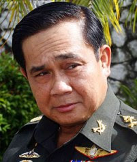
The announcement was part of a series of statements that accompanied the visit of Thailand's army chief to Cambodia. General Prayuth Chan Ochu made a two day visit to Phom Penh, and he promised on Monday 20th December that his government would not allow any group to use Thai territory to mistreat Cambodia.

The visit also saw the release of three Thai villagers that were imprisoned for spying after being caught on the wrong side of the border while hunting and foraging. They were freed on 21st December from a Siam Reap prison upon receiving a royal pardon from King Norodom Sihanouk to mark the 60th anniversary of the Thai-Cambodian diplomatic relations.

General Prayuth said in an interview on his return from Cambodia that the relations between the two countries had been strengthened by his visit. Tension between the neighbours reached a high in July 2010 over Cambodian plans for the Preah Vihear temple, which sits in the border region, but relations have improved since and the top leaders of both countries have met four times this autumn.

General Prayuth only took office in September, and he said the purpose of his visit was to introduce himself to Cambodian Prime Minister Hun Sen. He thanked Hun for his efforts during the last two months to ease the tension, and in response Hun said that Cambodia will insist upon peaceful negotiation with Thailand, and will avoid military confrontations.

As well as announcing that Cambodia will open its side of the border near Preah Vihear, Hun encouraged Thailand to reopen its side of the border. Hun also said that demarcation of the common border should be carried out as soon as possible. He said that he expected the Joint Boundary Committee (JBC) to hold a meeting in the new year.

"Since we are neighbours and cannot move away from each other, we should cooperate and stay together in peace.”

"Thailand and Cambodia are like a tongue and teeth which must be in contact. It is not right that the teeth must be removed if the tongue is bitten," the Cambodian prime minister said to Gen Prayuth.

During the holiday period, both Thai and Cambodian military leaders are expected to visit their soldiers in the Preah Vihear area to show that their troops are still in the disputed area, but without confrontation. The meeting also resulted in an agreement that Cambodian troops will be sent to Thailand to study the Thai military.

Sources: Bangkok Post, People's Daily
For more information on Thailand and Cambodia's land and maritime border disputes, please see the Menas Borders website.

Monday 20 December 2010

Border Focus: Kashmir

Indian soldier in Kashmir


What is disputed?

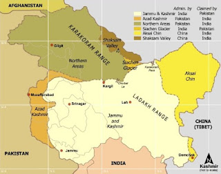
The name Kashmir is used to include the Indian-administered state of Jammu and Kashmir, the Pakistan-administered state of Gilgit-Baltistan (formerly the Northern Areas) and Azad Kashmir and Jammu, and the Chinese-administered regions of Aksai Chin and the Trans-Karakoram Tract.
India controls the majority of the area, occupying 101,338 square km (39,127 square miles), Pakistan 85,846 square km (33,145 square miles) and China, the remaining 37,555 square km (14,500 square miles).

None of the sides have accepted the occupations of the other sides to be permanent India claims the entirety of the area to be Indian, whereas Pakistan generally takes the line that the area is disputed. It is illegal for maps in India to display the area as anything other than fully Indian, but the majority of international maps consider the area to be in dispute.

How did the dispute start?

The dispute over Kashmir is a result of Britain's hasty decolonizing program in 1947. Kashmir was ruled by a monarch, under British tutelage, for the majority of the colonial period, and when Britain split the country into India and Pakistan, it was decided that the princely states would choose themselves whether to join India or Pakistan, or to remain independent.

Jammu and Kashmir was the largest princely state, and while it had a Hindu ruler – Maharaja Hari Singh – it was predominantly Muslim, and on partition Pakistan expected Kashmir to be annexed to it.
When Singh failed to make a decision either way after the 14-15th August Independence days passed, Pakistani tribals and militias entered Kashmir, intending, essentially, to frighten the Maharaja into submission. Instead, Singh appealed to the British governor-general, Lord Mountbatten, and the new government of India for assistance. India could not help, however, because India and Pakistan had signed an agreement of non-intervention. Although tribal fighters from Pakistan had entered the territory, there was no conclusive evidence that the government of Pakistan was officially involved, and so it would have been illegal for India to enter without Singh acceding to India.

Singh became desperate when Pakistani tribals reached the outskirts of Srinagar, and so Singh signed an agreement, known as the 'Instrument of Accession' with Lord Mountbatten, ceding Jammu and Kashmir to India. Indian soldiers entered Kashmir soon after and drove the Pakistani tribals from all but a small section of the state, and in December 1948 a ceasefire was agreed under UN auspices.

The UN Security Council passed Resolution 39 in January 1948, establishing a special commission to investigate the conflict, and passed Resolution 47 in April of the same year, which ordered the Pakistani army to retreat from Jammu and Kashmir and for a plebiscite to be held in which those habiting in Jammu and Kashmir would determine their nationality. Pakistan failed to remove their military presence, and so India argued that the plebiscite could not go ahead. Ownership of Kashmir has been disputed ever since.

When did China get involved?

In the late nineteenth and early twentieth centuries, Great Britain tried to establish the northern boundaries of Kashmir through agreements with Afghanistan and Russia. China, however, never accepted these agreements, and considers parts of eastern Jammu and Kashmir to be part of Tibet, and therefore Chinese.

In the early 1950s, the Chinese army started extending its reach, and since then have occupied what they call Aksai Chin. In 1962, China and India fought a brief border war over various areas under dispute, including Aksai Chin, and Chinese success meant that they have administered the area since. The line that serves as the border in this region is called the 'Line of Actual Control'.

Another portion of land, called the Trans-Karakorum Tract was ceded by Pakistan to China in 1963.
How serious is the dispute?

The dispute over Kashmir has resulted in numerous conflicts between India and Pakistan and has been a major thorn of the sides of the neighbours' relations since their inception in 1947.

Particular incidents of note include the Indo-Pakistani War of 1965, a five week war that started after tens of thousands of Pakistani soldiers crossed the 'Line of Control' dressed as Kashmiri locals. After trading territory for a few weeks, a stalemate was reached, and a ceasefire was negotiated in Tashkent, with both sides agreeing to return to the pre-war lines.

Tensions began to rise again after a disputed election in Kashir in 1987, and what started as a peaceful rebellion against the Indian government became an armed uprising. The first armed rebel group was the indigenous Jammu and Kashmir Liberation Front (JKLF) but Islamic militant groups proliferated rapidly.

The position of Pakistan in the rebels' actions is debated. Based in Pakistan-administered Kashmir, they found financing and recruited from within Pakistan. India and many international observers believe they were – and are – aided and guided by Pakistan's intelligence agency, the Inter-Services Intelligence (ISI), although Pakistan maintains they receive only moral support and diplomatic support.

In mid-1999, insurgents and Pakistani soldiers infiltrated into Jammu and Kashmir. During the inhospitable winter months, Indian forces regularly move to lower altitudes, leaving the LOC vacant. The insurgents took advantage of their absence and occupied the mountain peaks of the Kargil range, thereby blocking the highway that connects Srinagar and Leh. This highway is the only link between the Kashmir Valley and Ladakh and Pakistan's actions sparked high-scale conflict between the two armies. Initially, Pakistan blamed the fighting entirely on independent Kashmiri insurgents, but it soon became clear that Pakistani paramilitary forces were involved. The Indian Army, supported by the Air Force, recaptured most of the positions, and both sides received intense international pressure to withdraw given their nuclear capabilities.

In the aftermath of the Kargil War, relations were severed, nationalism rose on both sides, and India took steps to increase its military preparedness. Relations since 2000 have risen and fallen: Pakistan clamped down on insurgent action in Kashmir in 2002, prompting a thaw in relations, but this was only successful for a few years, and relations took a severe hit in 2008 when Lashkar-e-Taiba (LeT), a militant group with alleged links to the ISI, attacked Mumbai.

Talks between the two sides resumed in early 2010, but with strong levels of mutual mistrust, it is unclear what will happen.


For more information, including analysis of possible settlement routes, see the full Menas Borders' Border Focus.
Thursday 16 December 2010

Refugees in border areas on the rise as Cote d'Ivoire uncertainly continues

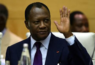
Alassane Ouattara is recognised as winning the Cote d'Ivoire Presidential Election


Ivoirians are leaving the Cote d'Ivoire for Liberia at a rate of around 150 people per day as political uncertainty continues in the wake of November's presidential election, according to the UN refugee agency (UNHCR).

Fearing political violence or even civil war, thousands of people have left Cote d'Ivoire and are settling in Liberian border villages.

The country's Independent Election Commission originally declared opposition leader and former prime minister Alassane Ouattara the winner in November's Presidential runoff. The Commission, which is run by an ally of the president, overturned the result after declaring some of the results from the largely Ouattara-supporting north to be fruadulent. Incumbent President Laurent Gbagbo has since been declared the victor, although the international community considers Ouattara the rightful winner.

The UN Security Council passed a resolution last week formally recognising Ouattara as the winner of the elections. US President Barack Obama echoed the Security Council in warning Gbagbo of repercussions if he refused to step aside.

The Cote d'Ivoire was once seen as a haven for peace and prosperity in West Africa, until civil war broke out in 2002. Armed rebellion by northerners, who felt they were being discriminated against, caused the country to be effectively split in two, with the north controlled by the New Forces (NF), and the south by the government.

Peace was agreed in 2007, and a leader of the NF, Guillaume Soro, became prime minster, while Gbagbo remained president. The tension after the November elections therefore prompts memories of the civil war, and many fear that fighting will break out again. Numerous supporters of Ouattara have said they are being threatened by Gbagbo supporters.

The majority of people fleeing the country are women and children, and many have come with little more than the clothes on their back. The UNHCR has said, “They urgently need food, clean water, sanitation facilities, clothing and basic hygiene items.”

Ethnic and family links means that many people living in western Cote d'Ivoire have relatives across the border, and most refugees are not living in tents, but with family members. Liberia has refused to set up refugee camps, and for now, Ivoirians are settling peacefully in border villages, although whether peace can be maintained is yet to be seen.

Before the current crisis, UNHCR was assisting 13,000 Ivorian refugees. Most of them – about 6000 – are in Liberia, but there are significant groups also in Guinea and Mali. The UNHCR said "As of Saturday [11th December], an estimated 3,500 people had entered Liberia with new arrivals reported in villages along the border at a rate now of around 150 people per day."

Liberia's President Ellen Johnson Sirleaf has warned Liberians, especially ex-fighters and rebels, who are often still present in the border regions, to stay out of the Ivorian crisis.

Sources: Liberian Observer, Mail & Guardian Online, BBC News
Wednesday 15 December 2010

Sudan round up: UN confirms SAF attack, SSRC in hot water, and Sudanese migrants returned home

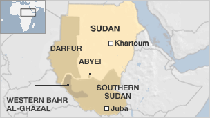
A UN investigation confirmed on Monday 13th December, Southern Sudanese claims that warplanes from the northern-controlled Sudan Armed Forces (SAF) had carried out attacks in locations in Southern Sudan near the joint border this month.

The Southern Sudanese government has complained repeatedly in recent months about bombings taking place. The most recent occurred in Timsaha in Western Bahr al-Ghazal province on 8th December, and while noone was killed, the Southern Sudan government has called for a UN commission of inquiry.

A spokesperson for the UN Mission in Sudan (UNMIS), Kouider Zerrouk confirmed the attack: "After verification, it was established by the CJMC members that air attack took place in the vicinity of Timsaha in Western Bahr al-Ghazal and no casualties have been reported."

Southern Sudan said last month that SAF representatives in the ceasefire monitoring body, the Ceasefire Joint Military Committee, which is chaired by the UN, admitted a previous bombing in the area on 14th November. SAF representatives allegedly said that the attack was part of the hunt for Darfur rebels.

Khartoum frequently accuses Southern Sudan publically of supporting and sheltering insurgents from Western Sudan, including Darfur, which borders Western Bahr al-Ghazal. Southern Sudanese officials deny the accusations and say the bombing is meant to increase tension in the north-south Sudan border area in the run up to the January independence referendum.

On 7th December, Southern Sudan minister of information Barnaba Marial Benjamin Bil accused the SAF of working to undermine the referendum by carrying out air attacks in Southern Sudan.

Legal challenge to SSRCOn 8th December, Menas Borders reported that a group of lawyers, backed by the northern ruling party, the National Congress Party (NCP) was seeking to file a lawsuit against the South Sudan Referendum Commission (SSRC), arguing that the commission had violated the interim constitution and the 2005 Comprehensive Peace Agreement (CPA) in conducting voter registration.

The lawyers filed their case on Sunday 12th December, and on 14th December, the Sudan Constitutional Court accepted the motion 'in form and content' according to one of the lawyers involved.

Ismail Hassan Haj-Hamad, head of the legal team that filed the challenge said that the next step would be for the court to consider their requests and would order the SSRC to file a response, before issuing a final ruling.

Haj-Hamad was quoted on the Sudanese Media Center (SMC) website saying that they had asked the court to annul all procedures arising out of the voter registration and to immediately halt the work of the SSRC. He said they are requesting the commission to be dissolved and for a new one to be established in line with the Referendum Act of 2009.

The court is expected to rule within three days.

Israel returns Sudanese migrants

In other Sudan related news, Israel confirmed, on Monday 13th December, that it was deporting 150 Sudanese migrants that had entered the country illegally. The UN refugee agency (UNHCR) has also confirmed that the migrants were being flown back to Sudan, via a third country, and that no coercion was involved.

Israeli officials said over 200 Sudanese had been flown out of the country in recent months after agreeing to return home, but that the operation on Monday was the largest yet.

The Israeli government estimates that over 30,000 Africans have entered the country illegally through its southern border in the last five years. Israel is taking an increasingly tough line with migrants; it is building a barrier along its border with Egypt to try to stop people from crossing illegally and has approved plans to set up a special facility to house those who are detained.

Israel says the migrants, most of whom come from the Horn of Africa, come in search of work, and are threatening local jobs.
Sources: BBC News, Sudan Tribune
For more information on the Sudan, please see menas borders


Tuesday 14 December 2010

Malaysia and Brunei resolve oil block row

Malaysian PM Najib with Bruneian Sultan Hassanal


Malaysia and Brunei signed a deal on 13th December to jointly develop two oil areas off Borneo, ending a border dispute dating from 2003 which had held up exploration.

The agreement will see the national oil firms of Malaysia and Brunei take part in exploration and production in the potentially oil-and-gas rich blocks, Malaysian state news agency Bernama said.

In the ceremony on Monday, Petronas and Petroleum BRUNEI signed a production sharing agreement (PSA) for Block CA2, with a lifespan of 40 years.

The signing ceremony in Brunei was witnessed by Brunei's Sultan Hassanal Bolkiah and Malaysian Prime Minister Najib Razak.

Brunei, a small monarchy surrounded by Malaysia's eastern states of Sarawak and Sabah, awarded exploration rights in one offshore block to French oil firm Total and another to Shell.

But Malaysia's state-owned Petronas awarded the same sites to US firm Murphy Oil and its own subsidiary, Petronas Carigali.

In a bid to end the spat, the two countries agreed in March last year that the disputed areas "are no longer part of Malaysia" but allowed Petronas to enter into new production sharing contracts.

In September 2010, the two countries agreed to jointly develop Block CA1.

After the signing ceremony on Monday, Najib said the percentage sharing agreement was still being discussed. He also said that he hoped joint demarcation and survey of the land boundary between the neighbours could be carried out next year.

Sources: Rigzone, Bernama, NNN


For more information on the Malaysia-Brunei offshore oil dispute, see menas borders.
Monday 13 December 2010

WSRW anger at Kosmos's Western Sahara exploration

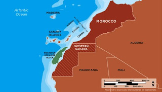
Kosmos Energy's blocks are offshore Western Sahara


Western Sahara Resource Watch (WSRW) has asked international banks to halt further funding of the US oil firm Kosmos Energy, according to a release from the group on 10th December. The company is exploring for oil offshore occupied Western Sahara.

The statement from WSRW said that should Morocco, through Kosmos, discover oil offshore Western Sahara, it will undermine the UN peace process in the territory, and risk destabilizing the fragile ceasefire in the region.

Western Sahara

The position of Western Sahara has been disputed for decades. After gaining independence from Spain, Western Sahara was divided between Morocco and Mauritania, but a group within the region, the Polisario Front, began a war for independence. Mauritania renounced its claims in 1979, and Morocco occupied the full territory. An International Court of Justice (ICJ) decision in 1975 and the 1991 UN Settlement Plan following a cease-fire upheld the right of the people of Western Sahara to hold an independence referendum.

Since then, talks and low-level disputes have continued, but the referendum has not occurred. Despite various settlement plans being put forward, certain sticking points remain that prevent any development on the region's fate. One of the central points is who would be allowed to vote in any referendum.

It has been reported that on the invitation of UN Secretary-General Ban Ki-moon's personal envoy Christopher Ross, representatives from Morocco, the Polisario, Mauritania and Algeria will meet from 16-18th December in Long Island, US, for the next round of talks. Talks were last held in early November 2010, when no agreement was reached.

Maritime control

While Mauritania renounced its territorial claims to the region in 1979 due to Polisario pressure, it did come to a maritime boundary agreement with Morocco which gave Mauritania control over some of the waters off of Western Sahara's shore, but hands the rest to Morocco.


WSRW said that according to the 2002 legal opinion from the UN Security Council Kosmos' actions offshore Western Sahara are illegal, yet despite this, Kosmos continues its exploration program.

While maintaining its program offshore Western Sahara, Kosmos is also the operator of a major oil find offshore Ghana. To develop the Ghana block, Kosmos earlier this year increased its project finance debt facilities by US$350 million, through agreements with Standard Chartered Bank, BNP Paribas SA, Société Generale, Crédit Agricole Corporate & Investment Bank, Crédit Suisse International, Citibank, NA, Natixis, HSBC, and FirstRand Bank Ltd.

WSRW has now appealed to these banks, as well as to International Finance Corp and Africa Finance Corp, to suspend further funding to the company.

We believe that your financial support to the company is highly unfortunate. It is our opinion that the firm shows no respect for the community in which it operates. We call on your firm to take measures as a responsible financial institution and avoid any further financial support to Kosmos, including in Ghana, until the firm has introduced and implemented a CSR policy, and started to respect the fundamental principles of human rights”, stated WSRW in a letter to the banks this week.

WSRW has for several years urged Kosmos to leave the territory, to no avail.

This small group of international banks has a golden opportunity to contribute in stopping an escalation of the conflict in Western Sahara. When the drilling in the occupied territory begins, the banks do not wish to be associated with this unethical firm. They need to address this issue with Kosmos while they still have a chance to do so,” stated Maiju Kaipiainen, chair of WSRW.

Kosmos carried out seismic surveys offshore Western Sahara in 2009.

Sources: Petroleum Africa, People's Daily

For more information on the situation in Western Sahara, see a menas borders briefing from 2009.
Help offered, but progress slow on Nicaragua-Costa Rica border dispute

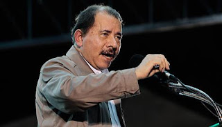
Nicaraguan President Daneil Ortega

Another country has joined the queue of parties offering to mediate between Costa Rica and Nicaragua. On 12th December, Costa Rica's vice-chancellor Carlos Roverssi and Ecuador's Ministro de Defensa Javier Ponce confirmed that Ecuadorian President Rafael Correa has contacted both Nicaraguan President Daniel Ortega and Costa Rican President Laura Chinchilla several times to offer his mediation.

The dispute between Nicaragua and Costa Rica dates back to October this year, and is centred on their border along the San Juan River. Nicaragua, who has sovereignty over the river, began a river dredging project in October, and was accused of dumping silt from the river onto Costa Rican land. Costa Rica also complained that the way it was being dredged would encourage the river to change course and move into Costa Rican territory. Nicaragua also stands accused of militarily occupying an island on the river.

Costa Rica, which does not have a military, asked the Washington-based Organization of American States (OAS) to intervene, and, in November, the organization twice requested that Nicaragua removed its troops, but Nicaragua refused. The case has now been referred to the International Court of Justice (ICJ) in the Hague, whose ruling on the matter will be binding.

With the case now in the hands of the ICJ, President Ortega seems to have given up on talks. Costa Rica's foreign minister, Rene Castro, said on 10th December, that the government of Nicaragua has rejected their proposal for dialogue. Costa Rica had apparently proposed a series of talks in Liberia, Costa Rica, for 20th December, but Ortega has said that now that the case is referred to the ICJ, he had no business attending Costa Rican-mediated talks.

Contradicting reports say that Ortega has agreed to have a dialogue with Chinchilla in the presence of 'friendly' nations and without conditions. On 10th December, Ortega said, "I am ready today to go anywhere presidenta Laura Chinchilla says, without any conditions."

It seems to be the question of conditions that is the sticking point. It was Chinchilla who apparently proposed the talks for 20th December, but said she would only attend them if Ortega had his troops removed from the disputed territory, and if OAS officials could act as mediators. Ortega is refusing to be restricted by any conditions whatsoever. He has said, however, that he is interested in carrying out the talks with 'friendly' nations as witnesses.

Costa Rica, however, argues that Ortega is being disingenuous. "President Correa proposes a commission of friend countries, but Nicaragua has refused. For that, the position of president Ortega is a lie: because President Correa has offered his country as well as Cuba, Venezuela, Colombia and Mexico as guarantors to the discussion or solution and Nicaragua rejected it", Roverssi said. Spain and the US have also offered their help in solving the dispute.

According to Roverssi, however, "There is nothing pending, the subject is frozen".

Sources: InsideCostaRica, Fortuna Times
For more information on the Costa Rica-Nicaragua border dispute, see the menas borders website.

Friday 10 December 2010

Border Focus: Angola and DRC

Thousands of DRC nationals have been expelled from Angola in recent years


What is disputed?
The irregular shape of both Angola and the Democratic Republic of Congo (DRC) has resulted in numerous conflicts between the two countries.

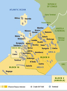
Many of the problems come from the fact than Angola is divided in two by a narrow strip of DRC territory. This narrow piece of territory is DRC's only access to the sea, giving it a coastline of only 37miles. Angola's territory north of DRC is an exclave, Cabinda, a region that has been engaged in a secession dispute for over 30 years.

Angola and DRC have both land and maritime disputes, and while they seem to be inching towards resolution on both fronts, continued political instability in the DRC and expulsions of nationals from both countries means full resolution is probably still many years away.

What is the history of Cabinda?

In 1885, the Treaty of Simulambuco established a Portugese protectorate over the area of Cabinda, through agreement with Cabinda's princes. Cabinda originally had the Congo River as its boundary with Angola, but in 1885, the Conference of Berlin extended Congo Free State's (ie DRC) territory along the Congo River to its mouth at the sea, creating the narrow strip of Congolese territory that exists today. Congo Free State was at that time under the personal rule of Belgium's King Leopold II, although it became an integrated Belgian colony in 1908.

Cabinda was called Portugese Congo while under colonial rule and it was an important area of raw resources, including oil found offshore Cabinda, for its colonial master. In 1974, political upheaval in Portugal resulted in Lisbon granting independence to all Portuguese Overseas Provinces in Africa. In the 1975 Treaty of Alvor, Cabinda was integrated into Angola, but this was rejected by all Cabindan political organisations. Angolan troops invaded Cabinda in 1975 to assert their authority, and groups in Cabinda have maintained a secession campaign ever since, albeit with varying intensity.

Why is Cabinda important?

Despite Cabinda's small size, its abundant natural resources, particularly hydrocarbons, mean it has been hotly disputed over by foreign powers and nationalist movements.

Cabinda first struck oil in Block Zero in the near offshore waters in 1962. The block has been producing oil since 1968, and for many years was the bedrock of Angola's petroleum industry. Major new discoveries were made in Block 14 in the 1990s and first production started in the vast Kuito oil field in 1999.

These blocks are controversial, however, because the angle at which they are aligned seriously restricts DRC's access to the sea. About 65per cent of Angola's petroleum comes from the regions off Cabinda, and DRC has long been claiming that it deserves a portion of the income.

The government in Kinshasa has argued that the generally accepted boundary is not the result of any international political agreement, but rather the result of an arbitrary agreement drawn up with Gulf Oil, which is now part of Chevron, after the Second World War. They argue that the dispute is depriving DRC of 200,000b/d.

The Angolan parliament approved a resolution in March 2010 authorizing the government to enter into negotiations with DRC to resolve their maritime border. Angola also plans to enter a claim with the UN to extend its maritime boundary from 200 miles to 350 miles offshore.

What are the prospects for the future?

Angola has established a Joint Development Zone (JDZ) with Conga-Brazzaville covering maritime territory beyond the area disputed by Angola and DRC and revenues in the 'Zone d'Interet Commun' are to be split 50:50. The zone covers mainly deepwater areas, encompassing part of Congo-Brazzaville's Haute Mer field, as well as Angola's Block 14.

The successful establishment of an agreement with Congo-Brazzaville gives hope that Angola might also be willing to establish a JDZ with DRC. DRC's position, sandwiched as it is between Cabinda and Angola, and with a very narrow coastline, however, will not give it a very strong bargaining position. It has been suggested that Angola is likely to take a very tough stance with the DRC, offering only the narrowest of corridors to the limit of its territorial sea, and DRC may end up struggling to get out to 200nautical miles. Still, that the two countries seem dedicated to discussions is positive.

Political instability in DRC has meant that the country has no offshore oil production currently, but this is likely to change in coming years. DRC seems to be keen to establish its boundaries in order to unlock the resources that lie close to many of its nine international borders. The Memorandum of Understanding that it signed with Uganda in December 2010 over Lake Albert is a positive step forward, and if DRC is able to fully establish some of its often porous and changeable boundaries, it will undoubtedly prevent undue human suffering.

For more information on the land dispute between Angola and DRC, as well as information on the expulsions of foreign nationals and mass rapes, see the full Border Focus.

Thursday 9 December 2010

Chile backtracks on Bolivian sea access deal

Chilean President Pinera celebrates the miners' rescue in October


Bolivian hopes of securing access to the sea through agreement with Chile took a major hit last week as Chilean Foreign Minister Alfredo Moreno confirmed that the new government of President Sebastian Pinera would not be supporting the agreement that had tentatively been reached between his predecessor Michelle Bachelet and Bolivia's Evo Morales providing land-locked Bolivia with sea-access in northern Chile.

Putting Chilean security concerns over bilateral relations, Moreno, speaking on a Chilean talk show on Sunday 5th December, said that while they were willing to cooperate and collaborate with Bolivia, they would never be willing to cede sovereignty. Moreno said, “we will never accept something that divides the country in two…Sovereignty is not on the table.”

This has proved to be an unpopular move in Chile, as Pinera's approval rating continues to slide after peaking after the miners' successful rescue in October, and many blogosphere commentators have argued that good neighbourly relations are more important than control of a small area of territory.

Bolivia had a Pacific shoreline until it lost it to Chile in the 1874-84 War of the Pacific, in which Bolivia allied with Peru to fight Chile, but lost. Indeed Bolivia has lost vast swaths of its territory to its neighbours since its independence from Spain in 1925. Bolivian bitterness towards the Chileans has persisted since, although Bachelet and Morales took important steps to mending relations.

In 2006, a 13 point agenda was established that included La Paz's demand for access to the Pacific. It appears that just before he took office, Pinera stopped Bachelet from signing an agreement with Morales in which Chile would cede a 'non sovereign coastal enclave' to Bolivia in the northern region of Tarapaca.

In October 2009, Morales and his Peruvian counterpart Alan Garcia, signed a deal giving Bolvia a 99-year lease to four square kilometres of desolate shoreline near Peru's southern port of Ilo.

When finalising the deal in a ceremony with Garcia, Morales said, "This opens the door for Bolivians to have an international port, to the use of the ocean for global trade and for Bolivian products to have better access to global markets.”

Pinera, however, has in this case blocked Bolivian access, arguing that handing the enclave to Bolivia would bring great "migratory, free transit, administrative and infrastructure problems" for Chilean authorities. Foreign Minister Moreno said that Chile will “analyse all the proposals for a (Bolivian) better access to the sea, but will always guard the interests of Chile, and that interest will never be to have the country divided in two.”

It seems therefore likely that Bolivia may still gain access to a sea outlet, but only under clear Chilean sovereignty. Pinera has been taking a tough line on security, increasing border security and signing new contracts with defense suppliers. Senior officials have recently said that the immediate security threats to Chile include large-scale immigration from its poor neighbours, as well as organised crime and narcotics trafficking.

The toughening of Pinera's stance towards Bolivia must be seen in this light: he is clearly worried that giving Bolivia control - even in a non-sovereign capacity - will compromise Chile's ability to control its territory. It seems he is also worried that offering access once could revive Bolivian ambitions towards other territories lost in conflict.

Bolivia, however, is likely to continue to press for sea access. According to the Bolivian minister for planning and development, Viviana Caro, direct access to the ocean wouldl cut the distance goods have to travel to Asian markets by 40per cent. Bolivia is keen to become competative in the Asian markets, to take advantage of its plentiful resources of zinc, tin and silver.

Sources: UPI, MercoPress, Democratic Underground

Wednesday 8 December 2010

South Sudan referendum preparation progressing, but Abyei talks break down

A southern Sudanese man living in Darfur registers to vote
The hopes of independence for the southern Sudanese got one step closer on Wednesday 8th December as voter registration closed, signalling the end of one of the biggest obstacles to the referendum taking place early next year.

More than three million southerners have signed up for the 9th January, 2011 poll, which is likely to split Africa's largest country in two, and create the continent's first new country since 1993.

Disputes and delays in registering voters had led many to suggest the vote would have to be postponed, an outcome that would likely please northern leader Omar al-Bashir, but threaten to return the country to violence.

There has been renewed international engagement in recent months, however, and the registration process proceeded smoothly in the semi-autonomous southern region. Despite the registration period, which was meant to end on 1st December, being extended for a week, it looks likely the vote will go ahead on time.

The independence referendum is the outcome of the 2005 Comprehensive Peace Agreement (CPA), which ended a 20 year civil war between the largely Arab north and largely non-Arab south, which claimed more than two million lives.

Though the peace has held since 2005, there is great mistrust between the northern National Congress Party (NCP), headed by President al-Bashir and the southern Sudan's People's Liberation Movement (SPLM). The SPLM have accused the NCP of trying to derail the referendum, and many southerners living outside the south chose not to register for the referendum, fearing that Khartoum would tamper with their votes.

A central issue is revenues from oil, as most of the country's hydrocarbon resources are located in the south. Currently the revenue from Sudan's 500,000 daily barrels of oil is shared between the north and the south, but the north stands to lose up to 75 per cent of its petrodollar income if the south separates.

Many southerners believe that al-Bashir will try to postpone the referendum to maintain its income. The UN and the international community, especially the US, have played a hands-on role in recent months, trying to induce al-Bashir to accept the results of the referendum, through offers of the easing of sanctions and debt relief. The International Crisis Group (ICG) thinktank has said in a recent report that al-Bashir's government was stalling to extract as many concessions from the south and the international community as possible.

Even if the vote does go ahead on schedule, key parts of the CPA, including demarcation of the north-south border and how oil will be managed, has not been decided. The oil issue is particularly tricky because the pipelines from the southern oilfields run through the north.

A number of southern figures backed by the NCP have recently announced that the vote is in violation of the interim constitution and the CPA, and are in the process of finalising a lawsuit against the South Sudan Referendum Commission (SSRC). The group has said they will ask for an injunction to prevent the SSRC from proceeding with its preparations for the referendum. If granted, it means that the exercise will have to be delayed until the court rules on the challenge. The lawsuit could be filed as early as Wednesday 8th December, according to the Sudan Tribune.

The NCP has in recent weeks accused the SSRC head Mohamed Ibrahim Khalil of turning a blind eye to 'blatant' violations committed by the SPLM in the registration process. They allege that the SPLM has intimidated potential voters not to register in order to make it likely that the referendum will result in a vote for succession.

Despite these issues, and the very tight deadline, it seems likely that the southern Sudanese will vote on 9th January, 2011. The same cannot be said of the Abyei region, which was due to vote to join either the north or the south on the same day. North-south talks on Abyei broke down in Ethiopia last month, and northern officials have said it would be impossible to hold on the vote on time.

US State Department spokesman Philip Crowley admitted as much on 7th December, when he said "I think we have a recognition that that referendum will not go forward on January 9th, but we continue to encourage the parties to work on a solution to Abyei."

The Abyei referendum commission has yet to be appointed and the parties remain divided on voter eligibility. There is some speculation that the vote will not take place at all in oil-rich Abyei. Rather, there may be a negotiated settlement, for example Abyei going to the south in exchange for something the north wants, according to Zach Vertin of the ICG.


Sources: the Guardian, Sudan Tribune

Friday 3 December 2010

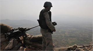
Migrant misery at Yemeni-Saudi border

A Saudi border guard looking into Yemen

Thirty migrants stranded on Yemen's border with Saudi Arabia have died in recent weeks, according to the International Organization for Migration (IOM).

Thousands of migrants are stranded in the Yemeni border town of Haradh, either still attempting to cross the border into Saudi Arabia, or having been deported out of the country and left at Harahdh with nothing more than the clothes on their back.

Most of the migrants are from Ethiopia, Somalia or Sudan, and have undertaken the long and dangerous journey across the Gulf of Aden, with the hope of settling in Saudi Arabia or other parts of the Middle East. Yemen is the major transit route for people from the Horn of Africa, and many of them are dehydrated, malnourished and in bad health by the time they reach Haradh.

Every day hundreds of illegal migrants are caught and sent back to Yemen, Saudi officials say. The Yemeni-Saudi border has historically been very porous. It was only officially demarcated in 2000 and until 2009 many villages dotted the border.

Since 2009, however, Saudi authorities have stepped up efforts to prevent unwanted border crossings, targetting not only migrants, but also drug smugglers and Yemen-based Al-Qa'ida opertives. Saudi authorities embarked on a multibillion dollar effort to strengthen the border. They evacuated dozens of villages straddling the border and built an elaborate defence network to keep intruders out.

Even with earthern berms, layers of barbed wire, floodlights and thermal cameras present, some still get through. “They adapt very quickly to every strategy we have,” Lt. Muhammad Qahtani, a Saudi border patrol veteran told the New York Times. Migrants wear their shoes backward to confuse trackers or strap sponges to their soles to prevent leaving footprints.

Migrants typically put up little resistence when caught, often too weak from the journey. “Some of them say, 'If you give me something to eat, I will go back,'" Qahtani says. Drug smugglers are a different story: many are heavily armed, and according to Qahtani will fight to the death when surrounded, knowing that drug traffickers are usually beheaded in Saudi Arabia.

The price of greater security in Saudi Arabia, however, is misery for the migrants. With no means of either continuing their journey or returning home, the migrants sleep out in the open, trying to survive on whatever scraps of food they can find.

The IOM works with Médecins Sans Frontières (MSF) and the UN to help the migrants, and have, since November this year, targeted 2,000 migrants in the area. Since 13th November, IOM have assisted 785 of the migrants to voluntarily return home after providing medical, shelter and food assistance, and they say that by early December, that number will have risen to over 1000.

We are seeing a dramatic increase in migrants needing help. Over the past week, the number of migrants being referred to IOM has jumped to about 76 a day,” says the IOM's operations officer in Haradh, Bill Lorenz.

The IOM has received funds from the UN's Central Emergency Response Fund (CERF) to help migrants. They have established a centre in Haradh where they can provide shelter and basic health services to migrants wanting to return to Ethiopia. But with political instability and economic hardship continuing in the Horn of Africa, more migrants will continue to arrive.


Sources: ReliefWeb, New York Times

Thursday 2 December 2010

Trouble between the Koreas rumbles on


It has been just over a week since the most recent trouble between North and South Korea broke out, and the political posturing – and military manoeuvring – continues.

South Korea's intelligence chief is reported to have said they think that North Korea is very likely to attack again. Won Sei-hoon, director of South Korea's National Intelligence Service, was quoted by South Korea's Yonhap news agency saying “There is a high possibility that the North will make another attack”.

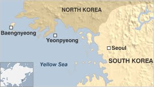
It must be considered, however, whether Seoul would have to take some of the blame if the North did attack, as their actions, and those of their ally, the US, seem very provocative. The South Koreans are building up their defences on Yeonpyeong island, the site of the conflict, and the US has sent warships, fighter jets and more than 6,000 personnel to the area, where 70,000 South Korean troops are already present.

On 28th November, the US and South Korea began carrying out joint military exercises in the disputed area. Beijing has expressed its anger at the joint military exercises. The Chinese Foreign Ministry said on 26th November, “We hold a consistent and clear-cut stance on the issue. We oppose any party to take any military acts in our exclusive economic zone without permission.

In July 2010, some 20 US warships and 200 planes carried out similar manoeuvres with the South Korean military in the waters bordering both North Korea and China, according to the International Action Center. The nuclear powered carrier, the USS George Washington, which carries 75 fighter jets and is currently in the Yellow Sea area, also took part in the July exercises. Beijing expressed their displeasure to the exercises at the time, and it must be asked why they need to carry out two major military exercises within such a short time frame.

Much of the Yellow Sea area is disputed by the two Koreas. A US-led UN team awarded it to South Korea following the 1950-53 Korean War, but North Korea has never acknowledged the boundary, known as the Northern Limit Line. It believes Yeonpyeong Island, and the waters surrounding it, to be North Korean territory.

The US and South Korea have also rejected China's calls for the resumption of the six-nation talks on ending North Korea's nuclear programme. The BBC suggests that Seoul and Washington are anxious to avoid the impression that bad behaviour from the North will be rewarded with talks or offers of aid.
Talks have been stalled since April 2009, but Pyongyang has recently expressed interest in restarting them. The US has said that talks cannot resume until North Korea apologises for the torpedoing of a South Korean warship in March, and stops further nuclear enrichment plants from operating. North Korea has denied any involvement in the sinking of the corvette Cheonan.

Others in South Korea, however, have suggested the worst may be over. "There will be ongoing measures to beef up our forces including the stationing of new weapons, upgrading our marines on Yeonpyeong island but I think on this particular crisis we are reaching the apex and we will see a gradual de-escalation," Chung Min Lee, ambassador for international security affairs, is reported by the BBC to have said.

Sources: BBC News, International Action Center

For more information on North Korea and South Korea dispute, see the menas borders website.

Monday 29 November 2010

Border Focus: North and South Korea

A South Koreans soldier patrols the DMZ


What is disputed?

In essence, the whole peninsula is disputed, as both the North and the South theoretically seek reunification upon their own ideological lines: neoliberal social democracy for the South and a militant communism for the North. But reunification has become an increasingly distant dream over the past half century as the systems have become fully entrenched in their respective spheres. On a more immediate basis, tension between the two countries centres around their border onshore, the Demilitarized Zone (DMZ), and their UN-designed maritime border, the Northern Limit Line (NLL).

What is the history of the dispute?The two Koreas were unified until the end of World War II. They were governed by the Korean Empire until it was brought under the Japanese sphere of influence following the Russo-Japanese War of 1905, and it was eventually annexed in 1910.


It was divided into Soviet and American occupied zones along the 38th parallel, when the Japanese were forced to relinquish control at the end of World War II. UN-supervised elections were held in the south in 1948, but when the North refused to participate, separate governments were created for each area.
Both nations, however, continued to claim sovereignty over the Korean Peninsula as a whole, and this led to the Korean War (1950-53), when the Soviet–backed North Koreans invaded. The UN, and especially the US, came to the defence of the South, and they succeeded in pushing the North’s troops beyond the original border. Fresh from its own civil war, Communist China came to the North’s defence and an 1953 armistice re-established the border near the 38th parallel. The Armistice Agreement of 1953 ended the fighting, but both nations are officially still at war as a peace treaty was never signed.


In the ceasefire of 1953, the DMZ was created, when each side agreed to move their troops back 2km from what had been the front line, creating a buffer zone 4km wide. The Military Demarcation Line (MDL) indicates exactly where the front was when the agreement was signed.


The MDL was extended into the sea by the US-led UN military forces after the ceasefire, and this Northern Limit Line now serves as the de facto maritime boundary. The 1953 Armistice Agreement specified that the UN Command (ie South Korea) would retain control of five islands, including Yeonpyeong and Baengnyeong Islands. The NLL was not part of the actual Armistice Agreement because the two sides could not agree how the territorial sea should be measured: the UN favoured three nautical miles, while the North favoured 12. The NLL, unsurprisingly, adopts the UN preferred option.


While both sides acknowledge the DMZ as the border between the two, the North does not accept the NLL, and since 1999 has been arguing in favour of a more southerly ‘West Sea Military Demarcation’.

How serious is the dispute?

The dispute between the two Korea’s is very serious, not only for the people living on the peninsula, but because any dispute between the two threatens to involve their international backers: the US for the South and China for the North.


Since the 1950s the tension on the peninsula has remained high and there have been numerous border clashes. A series of low-level armed clashes around the DMZ area between 1966-69 has been called the Second Korean War by some; there have been numerous assassination attempts on South Korean presidents by the North; and the North has dug at least four tunnels crossing under the DMZ in what appears to be preparation for a military strike. The North claims that they are for coal mining, and the walls have been painted black to give the appearance of coal.


The South, and their American allies are not innocent either, and there have been numerous incidents of American helicopters and other aircrafts invading northern airspace. They have been shot down on at least two occasions.


There have been political wrangling as well as military, including the bizarre 'flagpole war' of the 1980s. The South Korean government installed a 98.4m tall flagpole with a 130kg South Korean flag in Daeseong-dong, a South Korean town that lies within the DMZ. In retaliation, the North promptly built what was then the tallest flatpole in the world at 160m, with a 270kg North Korean flag, near Panmunjom, the town on the MDL where the Armistice talks took place in 1953.


Also on the MDL is the Joint Security Area (JSA), where all negotations since 1953 have taken place. Amusingly, the area has been built so that the MDL goes through conference rooms, and even down the middle of conference tables, so North and South Koreans can meet face to face while remaining on their own jurisdiction.


The NLL has also been the cause of numerous disputes. The fact that it enforces a 3 nautical mile territorial sea has prevented the North from accessing its rightful Exclusive Economic Zone (EEZ), as dictated under the UN Convention on the Law of the Sea. As a result, the North does not recognise the line, and its fishing boats consistently work close to, or over, the limit line, often escorted by North Korean naval boats.


What has happened in recent years?

Relations began to improve in the early 1990s, with the 1991 'Agreement on Reconciliation, Nonaggression and Exchanges and Cooperation between the South and the North' (also known as the ‘Basic Agreement’) which acknowledged that reunification was the goal of both governments, and the 1992 'Joint Declaration of the Denuclearization of the Korean Peninsula'.

Sino-Russian border compromise results in joint development of Heixiazi Island

Heixiazi Island, the orange portion is what China acquired in 2008

Proof that compromise over border disputes can benefit everyone involved, an island that used to be a major source of conflict between China and Russia is set to become a major tourist and business hub.

Heixiazi Island (Bolshoi Urrusiysky Island to the Russians) is a 327square km sandbar in the middle of the confluence of the Heilongjiang and Wusuli Rivers (also known as the Amur and Ussuri Rivers). The Russians have occupied the island since 1929, when Soviet troops took it during a border clash, but the two countries reached an agreement in July 2008 to share it. The Russians simultaneously returned Yinlong Island (Tarabarov Island). The agreement officially marked the end of demarcation of the 4,300km Sino-Russian border.

The Chinese half of the island is currently off limits, and guarded by the military, and the local Heilongjian government is planning to develop it into a northern winter resort, drawing tourists from nearby Russia, Japan and South Korea. The local government plans to invest some US$1.47 billion in Heixiazi, with plans for hotels, a free trade shopping centre and an industrial park. The Russians have previously used the island as a military base, and it is only sparsely inhabited.

Much of the Chinese development plans are directed at the Russians. The industrial park, for example, will house factories making products for the Russian market. Khabarovsk, one of the largest cities in Eastern Russia, is nearby Heixiazi, and is set to be linked with the island through jointly-developed roads, bridges, ports, a railroad and possibly an airport. Khabarovsk is well connected to the rest of the country by rail, thereby enabling Heixiazi’s products to reach the wider Russian market.

Heilongjiang province has had considerable success developing its tourism industry. Sun Island, in the middle of the Songhua River near Harbin, is a summer resort, featuring beaches, theme parks and a reserve for the endangered Siberian tiger. In the winter, it is the site of the popular Harbin Ice Festival.

Not everyone in China was happy about the resolution of the border disputes with Russia. Much of what is now the Sino-Russian border was a legacy of treaties between first the Qing Dynasty and the Russia empire, and later the various Chinese governments dealings with the Soviets. Many in China consider these treaties to be ‘unequal’, especially regarding territory in Manchuria and Mongolia. Many in China thought they rightfully deserved the whole of Heixiazi island, not only half.

Still, with property developers ready to move in, and northern China set to benefit from wealthy Russian and Japanese tourists, those who were against the agreement may come to see half as better than nothing.

Tuesday 23 November 2010

Anti-North Korea bias skews reporting of island crisis


A look at any news website this morning will have told you that North Korea has attacked a South Korean island, killing at least one soldier and injuring numerous military and civilian personnel.

As far as background information goes, they will probably tell you that the North and the South never officially ended the 1950-53 Korean war, and that the North fired a torpedo in March 2010, sinking a South Korean ship and killing 46 people. The shadowy nature of the North Korean regime will be raised, as will their nuclear programme.

Part of the problem with any reporting on the Koreas is that in the West, we generally get our information from the South. In the world of 24 hour news, the media is looking for instant experts and official quotes, and these are unlikely to come from the North. Due to the time difference, this new crisis has been reported as part of the morning news. Opinions are made at the first reading, and the largely anti-North Korean western media immediately blames Pyongyang. In fact, if the media had waited, there would have been time to hear from the North, who in the late morning UK time, released a brief statement accusing the South of firing first. "Despite our repeated warnings, South Korea fired dozens of shells from 1pm ... and we've taken strong military action immediately," the North's official KCNA news agency said in a brief statement.

A similar situation occurred over the sinking of the Cheonan in March 2010. The North was immediately accused by the South and the US, and it was, of course, no surprise when an “international” investigation, ie one run by Seoul and Washington, found their accusations confirmed: they were unlikely to find anything else. The reclusive nature of the Pyongyang regime, of course, doesn’t help the North’s reputation in the world, but it seems that at least due consideration should be given to the North’s defence. In early November, Pyongyang released a detailed defence, pointing out that the international investigation found that an aluminium torpedo sank the warship, whereas all of its torpedoes are made of steel alloy.

It is as yet unclear what the truth of this most recent skirmish is, though that hasn’t stopped wild rumours of Kim Jong-il’s death from flying around the internet. Nor has it prevented UK Foreign Minister William Hague from issuing a statement, saying the UK “strongly condemns North Korea's unprovoked attack on the South Korean island”. Who fired first may never be known, though it can be sure that most of the world will continue to blame the North.


For more information on the Korean dispute, see the menas borders website.

Monday 8 November 2010

Nicaragua and Costa Rica in border row over Google maps

The 'Bing' map with the 'Google' map inset

Google maps has been in the news again, this time at the centre of a dispute between Nicaragua and Costa Rica. The events have played out curiously over the last week, receiving huge media attention, and it is not yet clear how it will be resolved.

The dispute centres around the San Juan River, which starts in Lake Nicaragua, and becomes the natural border between Nicaragua and Costa Rica for much of its 120 mile course to the sea. For more than a century, the countries have sparred over navigation and fishing rights on the river, although the issues were largely settled by an International Court of Justice (ICJ) ruling in 2009.

The ICJ decision regarded that Costa Rica has navigational rights on the river, but that Nicaragua maintains the power of regulation. In essence, they ruled that in the regions under dispute, the border lay, not in the middle of the river, but on the Costa Rican bank. The river itself is in Nicaraguan territory.

The problem with boundaries based on natural features like rivers is that they can change, sometimes naturally and sometimes due to human intervention. Nicaraguan President Daniel Ortega started a dredging project in the river in October this year, and it is this that caused the dispute to flare up.
The dredging project aimed to remove the river sediment that makes it hard to navigate the water; it was also however, hoped that deepening the river would redirect the water back up to Nicaragua, after heavy sedimentation had driven the flow into Costa Rican territory for the last 20 mile stretch toward the Caribbean.

The Costa Ricans, unsurprisingly, were not happy about the plan, especially when Security Minister Jose Maria Tijerino revealed photos showing that the river sediment was being dumped on Costa Rican territory. Ortega had communicated his plans to San Jose, of course, but the Costa Ricans accused the Nicaraguans over breaking promises.

We had a guarantee,” Costa Rican Vice Foreign Minister Carlos Roverssi, told reporters Tuesday 26th October. “They were going to conduct only a small dredging that wouldn't affect Costa Rican territory. But what happened is a violation of our national sovereignty … that changes the circumstances.

Farmers on the Costa Rican side have also alleged that a group of armed men have invaded their land, harassed workers and killed livestock.

It is this land invasion that has gotten Google in trouble; it is also the point in which most media coverage starts, ignoring the crucial background to the story. The leader of the dredging project is Sandista revolutionary hero Eden 'Comandante Cero' Pastora, a close ally of the Nicaraguan president. Upon being accused of crossing the border, setting up camp on a disputed island and replacing a Costa Rican flag with a Nicaraguan one, he blamed Google Maps, saying he was in territory that internet giant had said was Nicaraguan. Many commentators have pointed out that it would be worrying if any government was that reliant on Google Maps, and have suggested that the Nicaraguans are using the map to justify a land grab.

Costa Rica put up a fuss, Google admitted the map was incorrect and blamed the US State Department for providing it with information that put the border 1.7 miles away from where it should be. On Friday 5th November Google geopolicy analyst Charlie Hale said in a Google blogpost that the State Department had provided a corrected version and "we are now working to update our maps."

The problem could have been solved there, except that the Nicaraguan government spoke up, saying the current Google map was actually correct. A further issue has possibly arisen too, with unconfirmed sources saying that Pastora has denied the Google connection. Apparently, he says that he was on Nicaraguan territory as prescribed by the Canas-Jerez Treaty of 1858.

The dispute has become so serious that the Secretary General of the Organisation of American States (OAS) Jose Miguel Insuza has flown to the region to help solve the conflict. He is expected to report on his progress on 9th November. On Saturday 6th November, Costa Rican President Laura Chinchilla said she was prepared to take the dispute to the UN Security Council if the OAS could not find a solution.

"Costa Rica is seeing its dignity smeared and there is a sense of great national urgency [to resolve this problem]," Chinchilla said after meeting Insulza.

There is no easy answer to this dispute. The 2009 ICJ decision relied heavily on the 1858 treaty, but there was great difficulty in determining the exact meaning of the treaty. It is interesting that both sides have claimed that the treaty will prove their view of the border region to be correct. Hale, for example, said Google was going to use the First Award of Arbitration of 1897, which affirmed the Cañas-Jerez Treaty of 1858, to redraw its border based on the Costa Rican request, while Pastora has said that the Treaty gives him the right be where he was. The situation will not descend into war – Costa Rica lacks an army – but both sides have increased official presence in the area. What Google will do awaits to be seen.

Sources: Globalpost, AFP, Google Blog, The Galloping Beaver Blog

Friday 5 November 2010

Border Focus: Indonesia and Malaysia


What is disputed?
Indonesian and Mayalsia have several border disputes, but the most important relates to an area called the Ambalat region in the Sulawesi sea.

Why is the area disputed?
The area is believed to be rich in hydrocarbons, and both countries have offered exploration blocks to IOCs. The area is also rich in sealife and has great tourism potential. The maritime boundary was not delimited during the colonial period.
What is the history of the dispute?
The roots of the dispute lie in a 1979 map issued by Malaysia, which outlined its territorial waters and continental shelf. The map drew Malaysia's maritime boundary running in a southeast direction in the Sulawsi sea, from the easternmost point of the land border on Sebatik Island, an island off the eastern coast of Borneo. The map included large parts of the Ambalat region inside its territory, and Indonesia and other surrounding countries quickly protested to the map.
What is considered to be each country's 'basepoints' is crucial in determining the limits of their maritime claim. In the 1979 map, Malaysia took the islands of Sipadan and Ligitan to be its basepoints, despite the fact that Indonesia had claimed them since 1959. The two countries took the dispute to the International Court of Justice (ICJ), which ruled in Malaysia's favour in 2002, based on its 'effective occupancy' (effectivités).
While the ICJ decision had no bearing on the Ambalat block itself, Indonesia was forced to amend its baselines, removing Sipadan and Ligatan islands as basepoints. In 2008, Indonesia redrew its baselines and as a result, the Ambalat Block was no longer entirely inside Indonesian internal waters.
Ambalat_blocks_in_Sulawesi_sea
 
How serious is the dispute?

The dispute over the Ambalat block has continued throughout this decade, with both sides awarding the blocks to oil companies. There are two blocks that are the major disagreement point: what Indonesia calls Ambalat Block and East Ambalat Block, and what Malaysia calls Block ND6 and ND7. The blocks are not identical, but they have large overlapping areas.

The deep sea blocks are estimated to contain at least 62 million barrels of oil and 348 cubic meters of natural gas. In 1999 Indonesia awarded Ambalat Block to ENI, and in 2004 it awarded Unocal the East Ambalat Block. In 2005, however, Malaysia's Petronas awarded Production Sharing Contracts to Shell and Petronas Carigali for both blocks.
There have also been skirmishes between navies, and on numerous occasions one side's fishing vessels have been arrested by patrol boats and accused of being in the other's territory. Both countries have a heavy naval presence in the area.
What are the possible solutions?
Malaysia said in 2009 that it would not refer the dispute to the ICJ, preferring diplomatic channels, which is positive. 2010 has seen both countries commit themselves to negotiations, and it seems that discussions will go ahead despite the fact that Malaysia is currently in dispute with Singapore over claims to Batu Puteh Island. The case has been referred to the ICJ, and while Malaysia previously said it could not resolve its dispute with Indonesia until it had resolved its dispute with Singapore, it looks like this issue has been circumvented.
In August 2010, Indonesia said it was looking into the possibility of temporarily turning the disputed border areas with Malaysia into a jointly managed territory to avoid more border incidents. The two countries have already established joint patrols in the Malacca Strait. This would be a positive first step, and could lead, ultimately, to the establishment of a joint development area in the Ambalat block. Joint Development Zones have been used successfully in other regions where resources straddle the border. Ultimately, until the maritime boundary is definitively established, both sides will lose out on the economic prosperity the Ambalat Block promises.
Cultural and political tensions continue to hind progress however. In 2009, there was uproar in Indonesia when a Malaysian tourism advert on the Discovery Channel featured a traditional Balinese dance called Pendet. One Indonesian politician even suggested they declare war on Malaysia as a result. Malaysia and Indonesia have a rich shared history – there was even a time when the idea of a pan-Malay region was floated – and it is unfortunate that the colonial experience, which created the two nations, and the demands of modern nationalism, which forces the cultures to delineate themselves so rigidly, has caused so many seemingly avoidable problems.
For the full article, please visit the Menas Borders website, here

Friday 29 October 2010

Border Focus: The Arctic


Seemingly endless expanses of icy tundra, punctuated only by the occasion polar bear: the arctic on first glance doesn't seem worth fighting over. But it has been the centre of a dispute between the five nations that border it for the last sixty years. Russia, Norway, Canada, Denmark and the US all make claims to the arctic waters, and more importantly, what lies beneath them.

It is thought that up to 90 billion barrels of oil and 30 per cent of the world's undiscovered gas resources could lie in the arctic region, and as receding ice caps make accessing this inhospitable region easier, the race to establish ownership has heated up.

Russia and Norway

In 2010, Russia and Norway settled their dispute in the Barents Sea, and the Norway has used the occasion to encourage the other arctic nations to make similar progress. In response to signing the Barents Sea Pact, Norwegian Prime Minister Jens Stoltenberg said "It sends an important signal to the rest of the world - the Arctic is a peaceful region where any issues that arise are resolved in accordance with international law."

Russia and Norway have been in the process of delimiting their maritime boundary since 1957, when a short section of the maritime boundary, from the land boundary terminus through the confines of Varangerfjord, was designated. The boundary was extended through Varangerfjord in 2007, but it was only in 2010 that the lengthy section through the Barents Sea and into the Arctic Ocean was determined.

Norway had argued for a median line, which would put the boundary exactly equidistant from each country's coast, which Russia (and previously the Soviet Union) advocated extending the boundary north along the 32° 4' 35"E meridian. The boundary agreed last week is a compromise between the two lines.

Russia and Canada

While Russia has solved one of its disputes, its problem with Canada continues. This dispute centres on the Lomonosov Ridge, a 1,200mile underwater mountain range running along the floor of the Arctic Ocean from Siberia to Canada's Ellesmere Island. Russia first laid claim to the ridge in 2001, arguing that as it is part of Siberia's shelf, Russia was entitled to sole rights to the ridge and the nearby seabed. The UN rejected this claim, saying more evidence was needed. Russia is expected to resubmit in 2011-12, with Canada and Denmark expected to offer evidence for their claims to the region in 2013 and 2014 respectively.

Denmark and Canada
Canada also has a stalled dispute with Denmark over Hans Island, a tiny barren knoll in the middle of the Nares Strait, which divides Ellesmere Island and Denmark's Greenland Territory. The maritime boundary in the area was delimited in a 1973 treaty, which plotted 127 points through the strait. The island, however, lies in between two points, and so has remained in dispute. At the heart of the dispute is shipping rights, and it seems that Canada is worried that giving in on Hans Island will compromise its exclusive claims to the Northwest Passage. With the exception of displays of power – visits to the island by prominent politicians, planting of flags, and the holding of army exercises – little has been done to resolve the dispute.

Canada and the US
More progress has been made on Canada's dispute with the US over the Beaufort Sea. High-level discussions have occurred over the summer in 2010, and for the third year in a row, researchers from both countries worked in the region mapping the sea floor. The dispute emerged in the 1970s, over a triangle-shaped 21,500sq km section of the Beaufort Sea close to the Yukon-Alaska shore, but the joint Canada-US seabed surveys in 2008 and 2009 showed each country's claims could extend much farther toward the North Pole than previously imagined.

Canada envisions a boundary that is an extension of the arrow-straight land border between the Yukon and Alaska, whic follows the 141 meridian. The US, by contrast, argues for a line based on 'equidistance'. What is interesting is that while each country's approach would benefit them in the restricted Beaufort Sea area, when the now accessible Outer Beaufort is considered, each of their approaches actually works against them.

Transnational concerns
A separate, but related concern is the issue of control over the Northwest Passage, which, due to retreating polar ice caps, is increasingly being seen as a shipping shortcut between Asia and Europe. Ottawa says that the Northwest Passage is Canadian sovereign water, but Washington and several other nations regard it as an international passage.

Meanwhile, the EU recently angered the Arctic Council, a group of arctic nations charged with protecting the environment, when EU Vice-President Diana Wallis said that, in allowing deepwater oil exploration in the region, they were failing to protect the fragile environment.

None of these disputes are likely to result in military conflict, but they have certainly hampered relations in recent years. As nations become increasingly eager to and able to exploit the natural resources in the region, it seem many of them will gradually edge towards resolution.


Read the full article, here.